

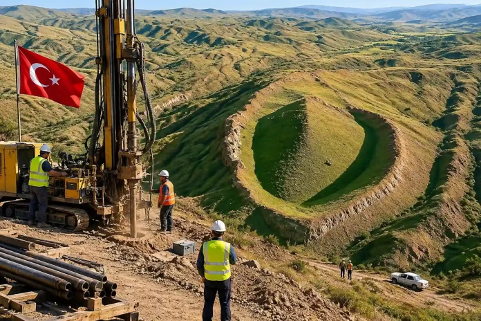
An international research team has begun core drilling at the Durupınar Formation in eastern Türkiye, a boat-shaped geological feature long linked by some to the biblical Noah’s Ark, as part of the most extensive officially permitted scientific investigation of the site to date.
The work, which started around September 21–23, 2026, is led by Professor Cenker Atila of the Archaeology Department at Sivas Cumhuriyet University in partnership with the U.S.-based group Noah’s Ark Scans, founded by researcher Andrew Jones. About 20 scientists and students from five countries participated in the broader 2026 field season, which ran from late June into September under authorization from Turkish authorities.
The Durupınar Formation lies near the village of Üzengili in Ağrı Province’s Doğubayazıt district, roughly 29 kilometers south of Mount Ararat (Ağrı Dağı) at an elevation of about 1,980 meters. Measuring approximately 157–164 meters in length, the elongated, hull-like outline was first widely identified in 1959 aerial photographs by Turkish Army Captain İlhan Durupınar. Its dimensions have been compared to traditional interpretations of the Ark’s length in the Book of Genesis, fueling decades of speculation, exploration, and debate.
Researchers used precision GPS mapping, three-dimensional digital modeling, high-resolution ground-penetrating radar, electrical resistivity tomography, and specialized subsurface imaging systems during the season. They collected roughly 1,000 soil and rock samples from about 150 locations both inside the formation’s outline and at control sites outside it. Core drilling—extracting narrow, continuous samples up to about 18 meters deep—marks a shift from remote sensing to physical evidence. The team also plans to deploy a custom underground robot nicknamed “Gopher” into any accessible voids.
Early reports from the expedition describe recovery of organic-rich layers interpreted by some team members as possible decayed material, multiple cavities (one of which continued to fill with water and mud), and the absence so far of continuous solid limestone or bedrock inside the drilled holes within the outline. In one hole, at roughly 4–5 meters depth, a drill bit shattered on a layer described as harder than limestone; petrified or highly mineralized wood has been suggested as one possibility requiring laboratory confirmation. Pottery fragments were also recovered. Earlier radar data had indicated subsurface anomalies, including linear features, right-angle intersections, elongated voids resembling possible corridors or chambers, and multi-level arrangements.
“For the first time in history, we are performing an extensive, permitted deep core drilling survey inside and outside the Durupınar Noah’s Ark site,” Jones said in a project statement. “We have so far recovered layers of rich organic material that we believe could be the decayed top tier remains of the Ark. … In one of the holes drilled inside the boat, approximately 4–5 meters below the surface … we struck a layer so hard that the drill bit broke. Petrified or highly mineralized wood are both a possibility we want to investigate through third party lab testing.”
Atila has emphasized a methodical approach. Samples are being analyzed for organic content, mineralogy, and potential radiocarbon dating, with laboratory work continuing through the winter of 2026–2027. Fuller results and a planned volume titled Durupınar Formation 2026 Research are expected in 2027, alongside additional field seasons. “Once the detailed soil analyses are completed, we expect to obtain important additional information that may bring us closer to understanding the true nature of the site,” Atila said.
The project’s university framing is cautious, aiming to determine whether the unusual shape is entirely geological or preserves any evidence of human activity. Noah’s Ark Scans researchers more openly pursue the hypothesis that the formation represents the remains of the Ark while subjecting it to rigorous testing. Documentary crews, including international teams, have been filming the work.
Skeptics, including many geologists, have long attributed the formation to natural processes such as earth flows or mudslides in a tectonically active region. Past claims at the site and others near Mount Ararat have not produced peer-reviewed confirmation of a large artificial wooden vessel. Radar anomalies, elevated carbon levels in some interior soil samples (reported around 40 percent higher in preliminary comparisons), and the new core findings remain preliminary leads pending independent laboratory verification and scientific publication.
Whether the cores ultimately reveal wood, structures or simply more of the local geology remains to be seen. For now, the drills are turning, the samples are bagged, and one of the oldest stories in the world is getting its closest modern look yet.

